Anna’s Utah Hiking Guide: Moderate, Moderately Difficult, Difficult Hikes in SLC & Surrounding Areas
- Anna Schmitz
- Sep 25, 2022
- 4 min read

Updated: Sep 29, 2022
I moved from Minneapolis, MN to Park City, UT in September of 2020. When I first moved here, I was working 3 12hr shifts and had a LOT of free time on my hands. I was hiking a minimum of 4 days a week and continue to get out on the trails as often as possible. That being said - I have covered a lot of ground and have hiked a lot of trails. I always get asked for recommendations on where to go, so I decided to compile a list of my favorite hikes based on level of difficulty. Here is a collection of some of my favorite moderate and moderately difficult hikes in Salt Lake City and the surrounding area, including: Little and Big Cottonwood Canyon, Centerville, Kaysville, Park City, Ogden & Antelope Island. **Ratings are based on my personal experiences on the trails and may not correspond with the AllTrails rating.
Click on the hike name to view the corresponding AllTrails map. Stay tuned for my favorite Challenging and Very Challenging hikes. And as always, remember to Leave No Trace.
"Take nothing but photos, leave nothing but footprints." Happy hiking 💕
**All photos taken by me.
Moderate Hikes:
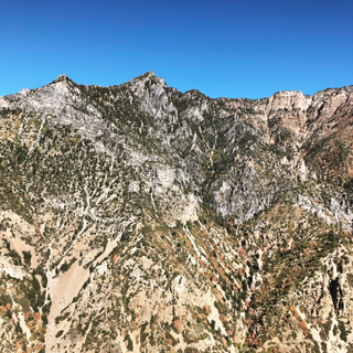
•Twin Peaks via Twin Peaks Connector - 3.4 miles RT, 1.2k ft elevation gain, dog friendly,
NO shade, great for sunset; The Avenues, Salt Lake City


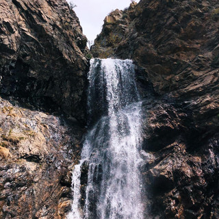
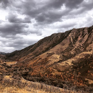
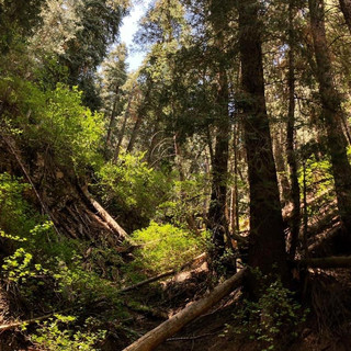
•Adam's Canyon - 4 miles RT, 1.4K ft elevation gain, dog friendly, waterfall at the end, relatively shady after the first 1/2 mile, great for seeing the fall colors; Kaysville


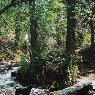
•South Deuel Creek - 5 miles RT, 1.3k ft elevation gain, dog friendly, lots of bridges and creek crossings, waterfall at the end, the road to get to the TH is very rough and high clearance is recommended ; Centerville


•Lake Lackawaxen via Bloods Lake Trail - 5 miles RT, 1.2k ft elevation gain, dog friendly but dogs cannot go near Bloods Lake, pay attention to signage, TH gets VERY busy VERY early on weekends; Park City, Bonanza Flat Conservation Area


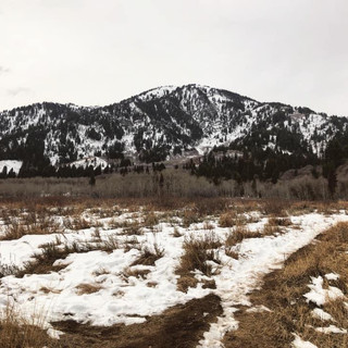
•Jack's Mountain - 2.5 miles RT, 1.3k ft elevation gain; East Bench, Salt Lake City


•Bell Canyon Lower Falls - 5.6 miles RT, 1.6k ft elevation gain, no dogs allowed; Sandy/Lone Peak Wilderness


•Timpanogos Cave Trail - 3.2 miles RT, 1.5k ft elevation gain, paved trail to the entrance of the caves, cave tours available, the caves were closed during my visit due to COVID; Pleasant Grove, American Fork Canyon


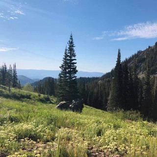
•Bald Mountain via Ontario Trail @ Deer Valley - 6 miles RT, 1.3k ft elevation gain, if you go during the summer you can hike up and take the ski lift down, parking is a beached here so I typically just pay the outrageous fee to park in the parking garage, note that the trail is often rerouted during mountain bike season, it is well marked on where to take the detour; Park City/Deer Valley


•Mount Van Cott via Red Butte Gardens - 2.5 miles RT, 1.1k ft elevation gain; Salt Lake City


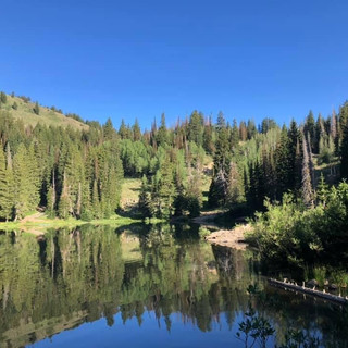
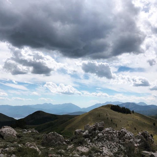
•Lake Mary, Martha & Catherine via Brighton Lakes Trail - 4.8 miles RT to Lake Catherine (3rd lake), 1.3k ft elevation gain, option for a loop around Dog Lake or to continue climbing to Sunset Peak, every *single* time I hike this trail I see a moose - keep your eyes peeled


•Ogden Canyon Overlook - 3.5 miles RT, 1.1k ft elevation gain; Snowbasin


•Ferguson Canyon - 3.5 miles RT, 1.5k ft elevation gain, I hiked this trail in the middle of January and it was too icy to make it to the end comfortably


•Salt Lake Overlook via Desolation Trail - 5 miles RT, 1.3k ft elevation gain, dog friendly, my favorite hike to do in a snow storm, also has a lot of shade so is a good option on hot summer days; Millcreek Canyon


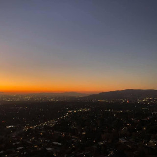
•The Livingroom Lookout Trail - 2.5 miles RT, 1.0k ft elevation gain, dog friendly, great for sunset; Salt Lake City


Moderately Difficult and Difficult Hikes:
•Grandeur Peak via Church Fork - 6.5 miles RT, 2.3k ft elevation gain, dog friendly; Millcreek Canyon


•Cardiff Pass - 3.5 miles RT, 1.6kft elevation gain, no dogs allowed; Alta


•Lake Desolation via Mill D North Fork - 8 miles, 2.0k ft elevation gain, no dogs allowed, no swimming in lake


•Frary Peak Trail - 7 miles, 2.4K ft elevation gain, dog friendly, great winter hike, state park fee + causeway fee required, during the winter time the road to the parking lot is closed, this adds about 1-1.5 miles and roughly 350-400ft of elevation gain; Antelope Island State Park, Syracuse


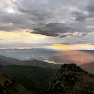
•Peak 9990/Desolation Peak via Tombstone to Fantasy Ridge - 6.5 miles RT, 2.4K ft elevation gain, take the Red Pine Gondola up to Red Line Lodge, hike includes a short rope/scramble section along Fantasy Ridge; Park City Mountain Resort


•Lake Blanche - 7 miles RT, 2.8k ft elevation gain, no dogs allowed, no swimming in lake; Big Cottonwood Canyon


•Mount Timpanogos via Aspen Grove - 16.5 miles RT, 5.3k ft elevation gain, started at 11:30pm & reaches emerald lake around 3:00am, took a 1hr nap in the shelter, continued hiking and made it to the peak around 5:16am; Sundance, Mount Timpanogos Wilderness


For more, check out my post: "Easy" Peaks to Bag


Comments