Anna’s Utah Hiking Guide: The Uinta Mountains + The High Uinta Wilderness
- Anna Schmitz
- Sep 26, 2022
- 2 min read

Updated: Jul 27, 2024
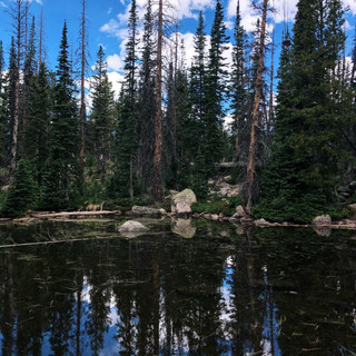
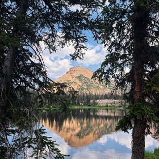
The Uinta mountain range is a very unique location. It is the highest range in Utah and is home to Utah's highest peak, King's Peak. The lowest point in this range is 8,000ft and King's Peak sits at 13,528ft. Along with hiking and backpacking, it is a very popular spot for fishing. There are over 1,000 lakes and 400 miles of streams. Atleast 500 of these lakes are stocked with fish. What is most unique, is that the Uintas are the only East to West mountain range found in the contiguous United States.
(Utah.com)
Below I have listed some of my favorite hikes in the area.
•Lofty Lakes Loop - 5 miles RT, 1.1kft elevation gain, dog friendly, passes by tons of lakes including Kamas Lake, Lofty Lake & Picturesque Lake; Hanna, Uinta Mountains


•Bald Mountain - 3.1 miles RT, 1.1k ft elevation gain, one of my favorite summits, the peak sits at 11,943ft, keep your eyes open for Mountain Goats; Coalville, Uinta Mountains


•20 Lake Trail Loop - 7 miles RT, 730ft elevation gain, this hike passes by many lakes including Wall Lake, Petit Lake, Watson Lake, Clyde Lake, North and South Twin Lake, dog friendly; Kamas, Uinta Mountains


Slate Creek Loop Trail: 5.6 miles, 1k ft elevation
gain - dog friendly - signs for trailhead are labeled Yellow Pine

Scenic Byway Trail: varies in distance and elevation gain and has many access points - I accessed the trail from the North Fork TH Parking Lot - dog friendly - I can’t find an official map of this trail, however it is on the Strava Map - click here to see my route


Clegg and Notch Lake via Notch Lake Trail: 5.3 miles, 550ft elevation gain - dog friendly - park at the Bald Mountain Trail Head


Comments