Anna’s Utah Hiking Guide: Easy & Easy-Moderate Hikes in Salt Lake City + Surrounding Areas
- Anna Schmitz
- Sep 25, 2022
- 6 min read

Updated: Oct 15, 2022
I moved from Minneapolis, MN to Park City, UT in September of 2020. When I first moved here, I was working 3 12hr shifts and had a LOT of free time on my hands. I was hiking a minimum of 4 days a week and continue to get out on the trails as often as possible. That being said - I have covered a lot of ground and have hiked a lot of trails. I always get asked for recommendations on where to go, so I decided to compile a list of my favorite hikes based on level of difficulty. Here is a collection of some of my favorite easy and easy-moderate hikes in Salt Lake City and the surrounding area, including: Little and Big Cottonwood Canyon, American Fork Canyon, Draper, Timpanogos Wilderness, Heber City and Park City. **Ratings are based on my personal experiences on the trails and may not correspond with the AllTrails rating. Also, keep in mind that "easy" hikes in Utah are still going to get that heart rate up and will provide a good workout due to the starting elevation (less oxygen!!). Click on the hike name to view the corresponding AllTrails map. Stay tuned for my favorite Moderate and Challenging hikes. And as always, remember to Leave No Trace.
"Take nothing but photos, leave nothing but footprints." Happy hiking 💕
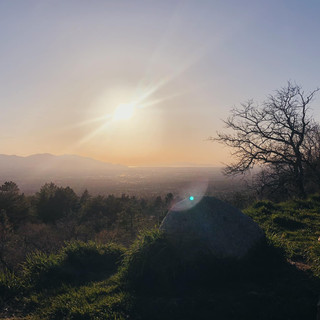
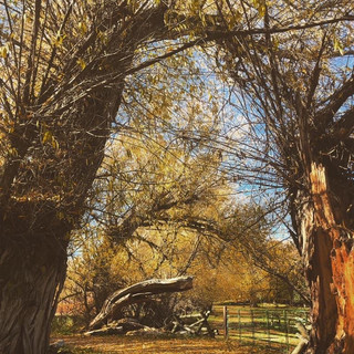
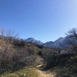
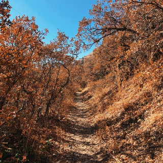
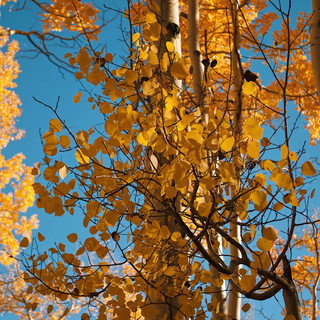
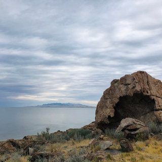
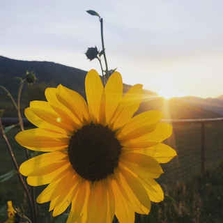
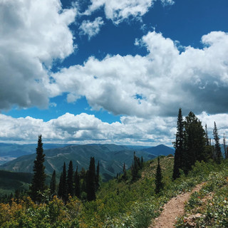
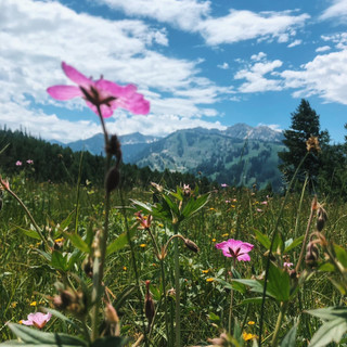
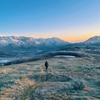
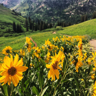
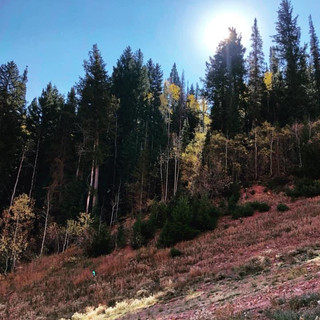
**All photos taken by me.
Easy Hikes:
• Ensign Peak - 1 mile RT, 450ft elevation gain, dog friendly, great for sunsets; Salt Lake City


• Bells Canyon Reservoir - 2.5 miles RT, 500ft elevation gain, no dogs allowed; Sandy


• Neff's Canyon Loop - 1.5 miles RT, 450ft elevation gain, dog friendly, off-leash; Salt Lake Valley


•Deer Creek Trail - variable distance up to 15 miles, variable elevation depending on distance, the first 2 miles in have about 400ft of elevation gain, great for trail running, multi-use trail; Midway


• PC Hill - 1.5 miles RT, 450ft elevation gain, dog friendly, great for sunset; Park City


• Round Valley Trail System - variable distance, elevation gain minimal and dependent on distance, dog friendly, these trails can be accessed from multiple areas, I typically park at the Quinn's Junction TH located right off the junction of I-80 and Hwy 40, this is a multi-use trail system, great for trail running; Park City


• Middle Provo River - 2-3 miles RT, 55ft elevation gain, full loop is 3 miles, this trail also connects to many other trails and can be made as short or as long as you'd like, it's great for trail running because it is flat, tons of water fowl around and a popular place for fishing, parking is located on the opposite side of the street from the trail; Heber City/Midway


•Riverview Trail System Trailhead - variable distance and variable elevation gain, I typically cross over the Timpanogos Canal and turn right and go about 1-1.5 miles out, which includes about 300ft elevation gain, TH parking located behind the UVU Wasatch Campus and is a multi-use trail, dog friendly, great for sunset; Heber City


•Big Cottonwood Regional Park - a few trails to choose from, easy to follow and most of them connect to eachother, minimal elevation gain, great for a walk during your lunch break, dog friendly; Cottonwood Heights


•Dimple Dell Regional Park - lots of trails to choose from, great for trail running, minimal elevation gain and variable distances; Cottonwood Heights


•City Creek Canyon Trail - up to 6.5 miles RT, up to 750ft elevation gain, I did 2 miles in, 4 miles RT, 450ft elevation gain; Capitol Hill, Salt Lake City


•Memory Grove Park - variable in length, minimal elevation gain, off-leash for dogs in specified areas; Salt Lake City


•Crestwood Park - multiple trails to choose from, great for trail running, minimal elevation gain, variable distances, dog friendly; Cottonwood Heights


•Utah State Capitol Loop - .7 mile loop, 50ft elevation gain, compacted gravel trail, dog friendly, great for running and at sunset, visit in April to see the Cherry Blossoms in bloom; Salt Lake City


• Donut Falls - 3.5 miles RT, 550ft elevation gain, no dogs allowed, can get VERY busy on weekends so be prepared to share the trail, keep an eye out for Pika (a small mountain rodent); Big Cottonwood Canyon


•Little Joe Loop - 3.2 miles RT, 500ft elevation gain, dog friendly, Bonanza Flat Conservation Area; Park City


• Cecret Lake - 2 miles RT, 500ft elevation gain, no dogs allowed, this trail can also be made longer and steeper by starting at Albion Basin TH; Alta


• Bloods Lake Trail - 3 miles RT, 500ft elevation gain, dogs allowed on trail but not near or in lake, pay attention to the signs just before the lake, dogs are allowed to go to the next lake, Lake Lakawaxen; Park City, Bonanza Flat Conservation Area


•Gloria Falls - 2.5 miles RT, 550ft elevation gain, no dogs allowed, this trail can also get very busy, it can be a little difficult to follow towards the end so I recommend downloading the AllTrails map or going with someone who has been before; Big Cottonwood Canyon


•Bear Canyon Suspension Bridge via Bonneville Shoreline Trail - 3.5 miles RT, 550ft elevation gain, multi-use trail, keep an ear and eye out for mountain bikers; Draper


•Alien Tower via Highland Blvd/Deer Ridge TH - 2.5 miles RT, 550 ft elevation gain, dog friendly; Draper


•Memorial Hill - 2.1 miles RT, 200ft elevation gain, dog friendly, trail goes in a circle up to the top of Memorial Hill, beautiful views of the Heber Valley, Deer Creek Reservoir and Provo Canyon; Midway


•Heber Valley Overlook - 2.3 miles RT, 250ft elevation gain; Wasatch Mountain State Park, Heber/Midway


•Lake Side Loop Trail - 5.2 miles RT, 350ft elevation gain, Antelope Island State Park, must pay the state park daily fee + causway fee; Syracuse


• Farm Trail/McLeod Creek - partially paved, dog friendly, minimal elevation gain, distance is variable depending; Park City


•Jeremy Ranch Road - up to 6 miles RT, 280ft elevation gain, this is not actually a "trail", but a dirt road often used by cyclists, runners, walkers etc., dog friendly but there can sometimes be stray cattle and horses so use caution, great for trail running and to escape the heat of the Salt Lake Valley during summer time; Jeremy Ranch/Park City


•Desolation Trail to Neff's Canyon Loop - 1.8 miles RT, 500ft elevation gain, this specific trail is not found on AllTrails, park @ Desolation Trail TH, hike up and at the fork go to the right towards Desolation Trail (at about .9 miles you will reach a fork), continue straight a few hundred feet, you will then reach another sign, go left (downhill) down Neff's Canyon and you will reach the first fork again, good short hike if the weather is cold; Millcreek Canyon


Easy-Moderate Hikes:
• Quarry Mountain - 2 miles RT, 850ft elevation gain, dog friendly, great for sunset; Park City


• Rattlesnake Gulch - 3.5 miles RT, 850ft elevation gain, dog friendly; Millcreek Canyon


•Primrose Overlook via Horse Flat Trail - 3.5 miles RT, 900ft elevation gain, toll fee needed at the entrance of the canyon, dog friendly; American Fork Canyon


• Willow Lake Trail - 2.6 miles RT, 700ft elevation gain, no dogs allowed; Little Cottonwood Canyon


•Little Mountain - 4 miles RT, 850ft elevation, no dogs allowed, great for sunset and after/during a snow storm; Emigration/East Canyon


• Iron Mountain - 3.5 miles RT, 900ft elevation gain, dog friendly, no TH parking, TH is in a neighborhood, to find TH type in "Iron Mountain Trail" on Apple Maps, remember this trail does pass through private property, this trail cannot be found on AllTrails so a map from the Hiking Project is linked; Park City


•Stewart Cascade Trail # 056 (Stewart Falls) - 3.8 miles RT, 700ft elevation gain, dog friendly; Mount Timpanogos Wilderness, Aspen Grove


• Albion Meadows - 3.5 miles RT, 800ft elevation gain, no dogs allowed, can be turned into a longer hike by continuing up to Cecret Lake, July is wildflower season and this is the hike for wildflower viewing; Alta


•Meridian Peak - 2.7 miles RT, 850ft elevation gain, dog friendly; North Salt Lake


•Timpanogos Lower Falls via Aspen Grove - 2.75 miles RT, 800ft elevation gain, dog friendly; Sundance, Timpanogos Wilderness


•Dooly Knob - 2.5 miles RT, 750ft elevation gain, dog friendly, requires state park pass + causeway fee, best to do in fall or winter to avoid bugs; Antelope Island State Park, Syracuse


•Armstrong & Dawns Trail Loop - 3.4 miles RT, 750ft elevation gain, note that part of this trail is shared with downhill mountain biking, hiking is allowed in either direction; Park City


•Rob's Trail - 4.2 miles RT, 780ft elevation gain, dog friendly, mostly shaded, beautiful views and a great fall hike, multi-use trail shared with up-hill mountain biking; Park City


Comments